
Sunday, May 26, 2002, was a beautiful day in the Black Hills of South Dakota. So Matt and I decided to take a hike on some National Forest land just to the east of the house. We headed down our back yard, crossed Nemo Road, then headed up the hill. When got to the top of the hill, looking to the east, we could see part of Rapid City. Here is Matt talking on the phone to his sister telling about the things we could see.

For those of you familiar with Rapid City, Diasour Park is located on the dark hill just below the horizon above Matt. You can see a small section of Nemo Road on the right center of the picture. That curve is just beyond the Westberry Trails road.
In this next photo, we walked a short distance back toward home. The area this photo was taken was just on the edge of the Westberry Trails Fire in the mid-1980’s. Very little clean-up has occurred as evident by the many dead trees. The two red arrows on the left side of the picture are a couple of our neighbor’s homes. The other arrow is where our house is, but you cannot see it because of the trees.

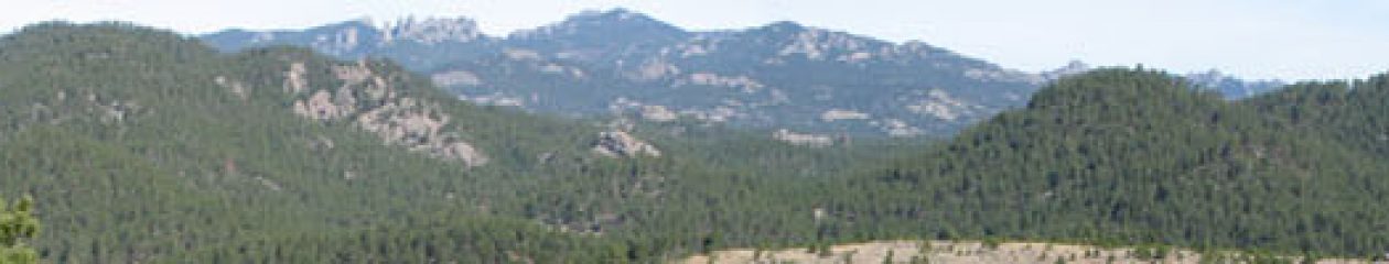
The mountain in the far distance of this photo is Harney Peak. Harney Peak is the highest point between the Rocky Mountains and the Swiss Alps. In May 2000, we climbed to the old fire watch tower at the very top of the mountain. We’ll do it again sometime.

Matt found a spot to dangle his feet off the edge, one thing he wanted to be able to do on our hike. If you every visit us and want to see this spot, we’ll be happy to take you on the short hike to it.

Spring is a wonderful time to do some hiking. Here is one wild flower we saw on our hike. It is pretty unique looking, with the petals folding all the way back up to the stem revealing the white, yellow and purple inside of the flower.

This photo is a close up of the flower, making it easier to see the interesting shape.

You must be logged in to post a comment.